
Use the map below to find a thermal drone pilot in Texas
Search with your location or zip code. Use the 150 mile option. Don't see a pilot nearby? We may still be able to help. Text 740-334-4099 with your zip code, and we'll see if we can connect you with a pilot manually. If you are interested in joining our drone pilot network, click here.
Lost Your Pet? We Can Help
The more time that passes, the harder the search becomes. We want to use every tool we have available to help locate your pet and bring them home. Even if we are not able to find your pet, we can offer peace of mind by reasonably ruling out areas where they could be.
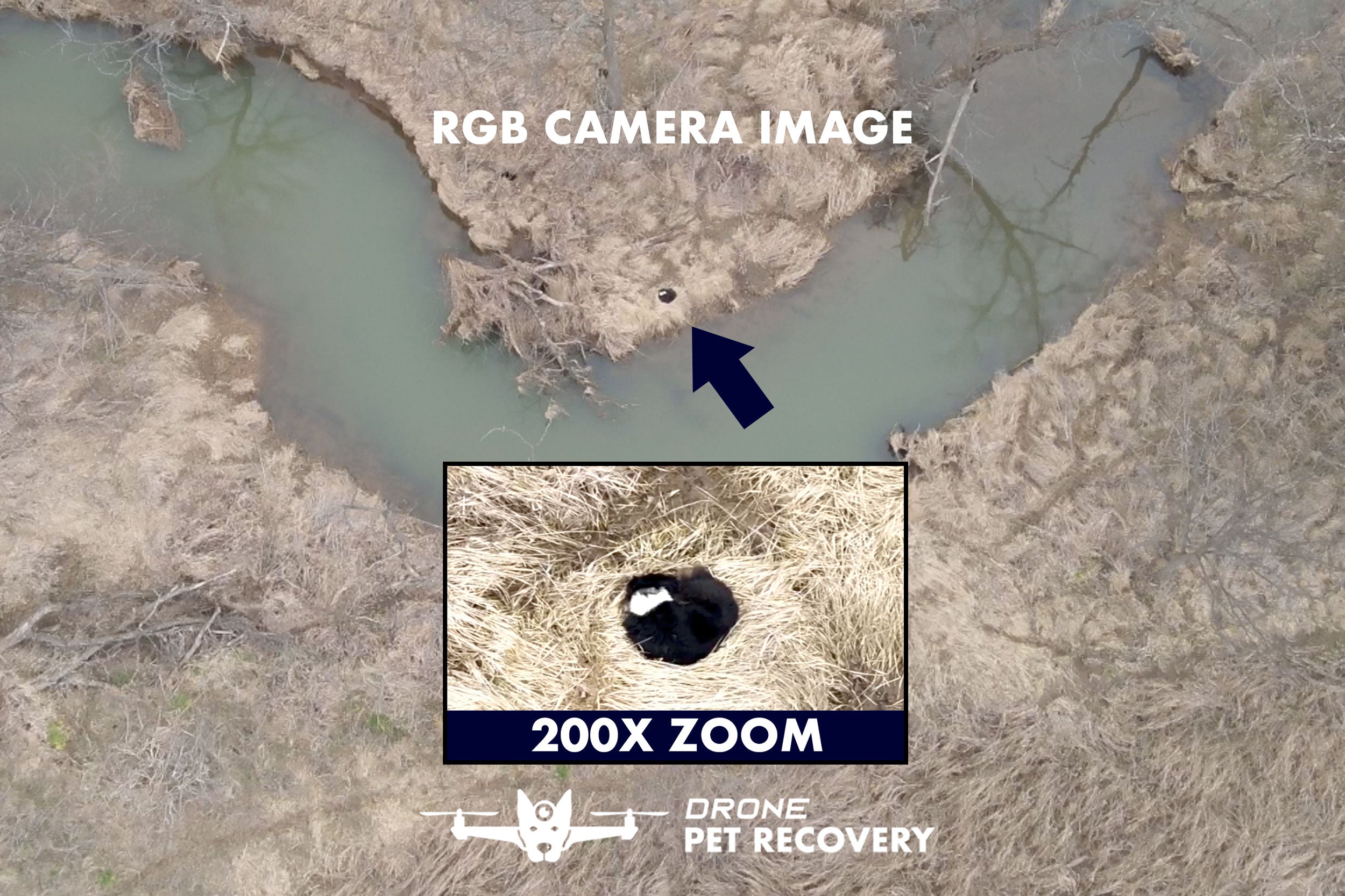 RGB Camera Image
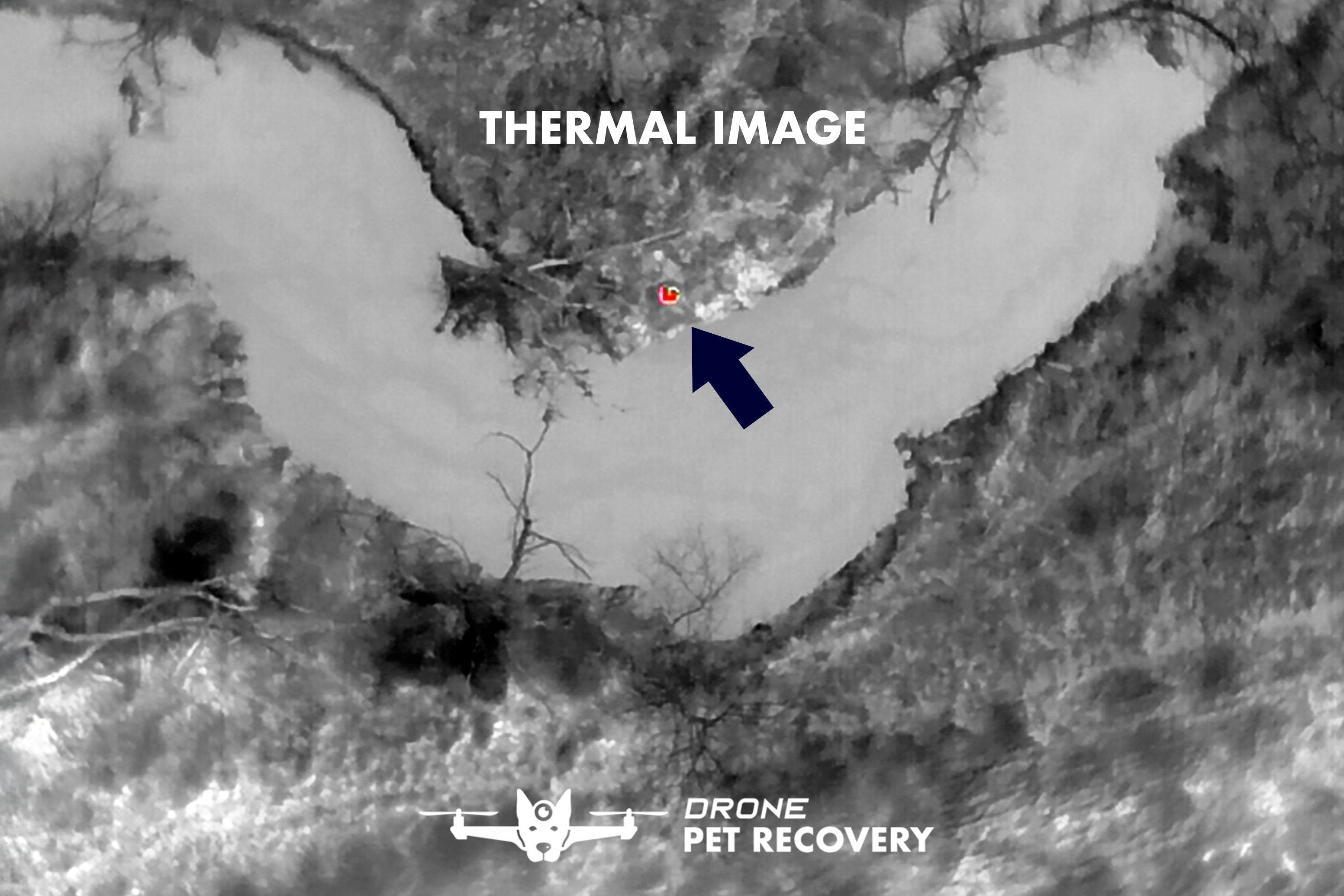 Thermal Image
How Thermal Drone Works
Thermal Signature
We fly over the landscape looking for a thermal signature contrast against the rest of the environment
RGB Camera
We then switch to an RGB (normal) camera to see what the thermal signature might be.
200x Zoom Camera
Our drone's 200x zoom camera allows us to zoom in to confirm that we have found your pet and allow us to track if needed.
-

Step 1: Call & Plan
We will talk you through your situation to determine if our services make sense for your unique circumstances.
We will want to know more about your pet. What kind? How big? How old? How long has it been missing or time since last sighting? Has s/he ever been lost before? Temperament?
We will want to know the terrain of your area. Is it rural, hilly, wooded, overgrown, open fields, etc.
-

Step 2: Setup & Search
We will make a plan based on the information you give us and we will begin as soon as we have established the search perimeter.
We set up our launch pad, charging station, viewing station and landing pad light at a high point near the search area.
You can see how the technology works on our 24″ mobile TV viewing station. As we identify heat signatures, you can help us determine whether we have found our target.
-

Step 3: Recovery
If we are successful in locating your missing pet, we will do what we can to aid you in the recovery process. Our drone can keep the pet in sight as efforts are made to bring them home.
We will provide onsite support with our drone to keep eyes on your pet. We try to help as much as possible with the recovery of your pet
For large animals such as livestock, we highly recommend that you have additional people or resources at your disposal to help capture the animal. Our primary service is in helping you find your animal.


First Steps When You've Lost Your Pet
- Take a deep breath, you are not alone. There's many folks out there who are ready and willing to help you find your lost pet.
- Put out some food for them and maybe an article of clothing or a blanket that has your scent.
- Post some photos and detailed information about your pet on local social media lost pet pages.
- Place "Lost Dog" signs near intersections with your contact information.
- Check with your local shelters daily and leave your contact info with them.
- Check back at home periodically- sometimes pets do find their way back home!
FAQs
Common questions about Drone Pet Recovery